Monday, August 29, 2016

Hope amid toxic desolation

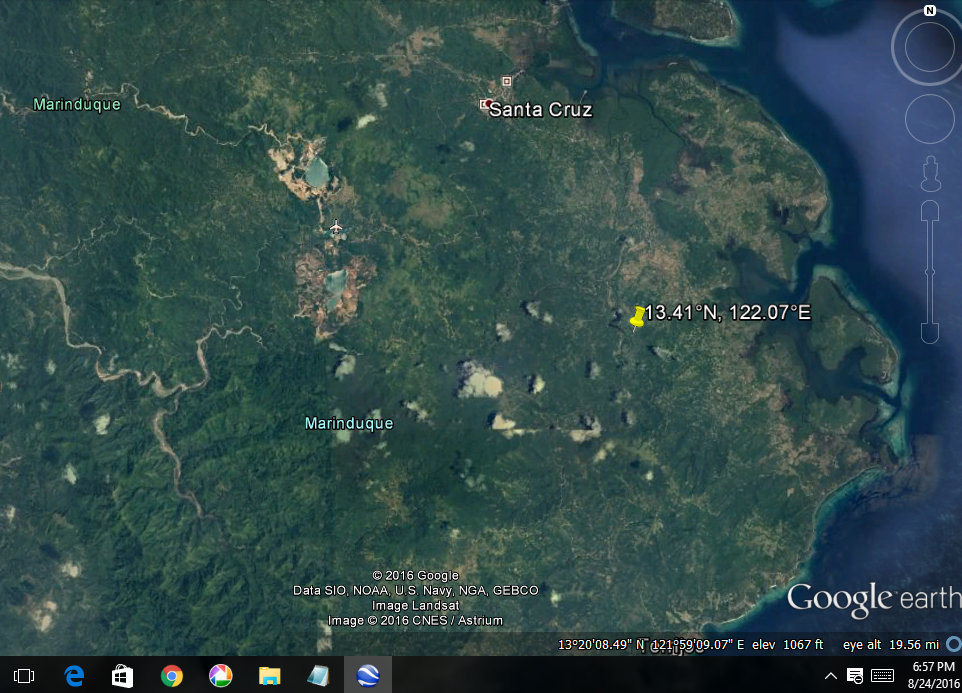
 Attorney Gerthie Mayo-Anda and Mrs Naty Nagutom meet in Marinduque for the hearing at the Regional Trial Court.

|James Clifford T. Santos, Legal Rights and Natural Resources Center


     At the witness stand, Nanay Natividad “Naty” Nagutom sat comfortably.  She appeared unflappable while on cross examination by the lawyers of Marcopper Mining Corporation (“Marcopper”). With great conviction, Nanay Naty testified that because of the December 1993 mining disaster allegedly caused by the Marcopper’s negligence , she and her family lost their sweet potato crops, banana trees, domesticated chickens and water source; suffered ailments caused by toxic mining wastes; and experienced deep anxiety and many sleepless nights among others.  

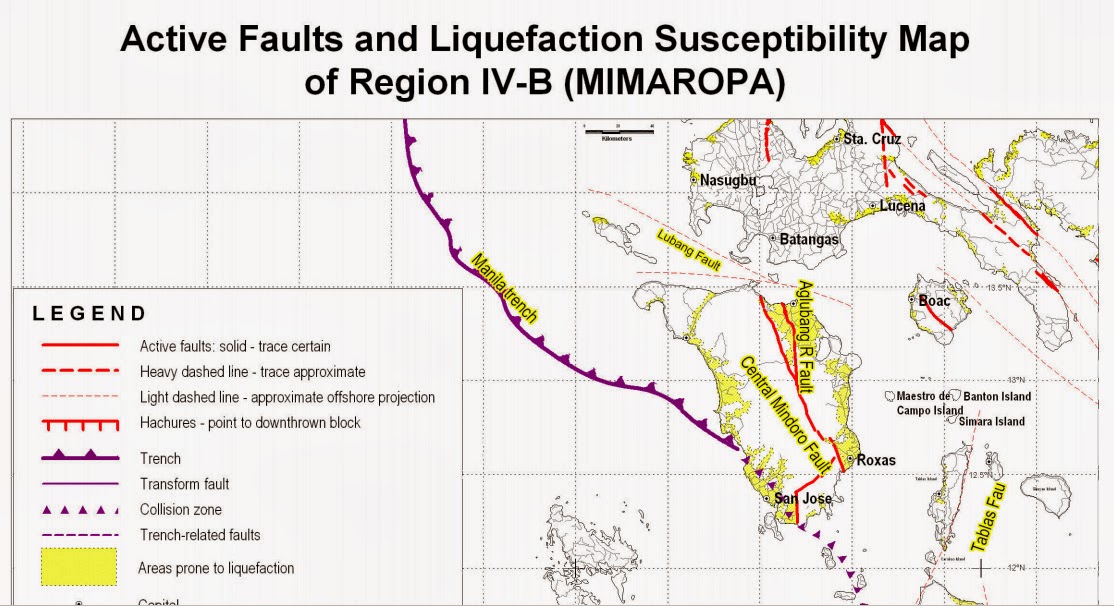
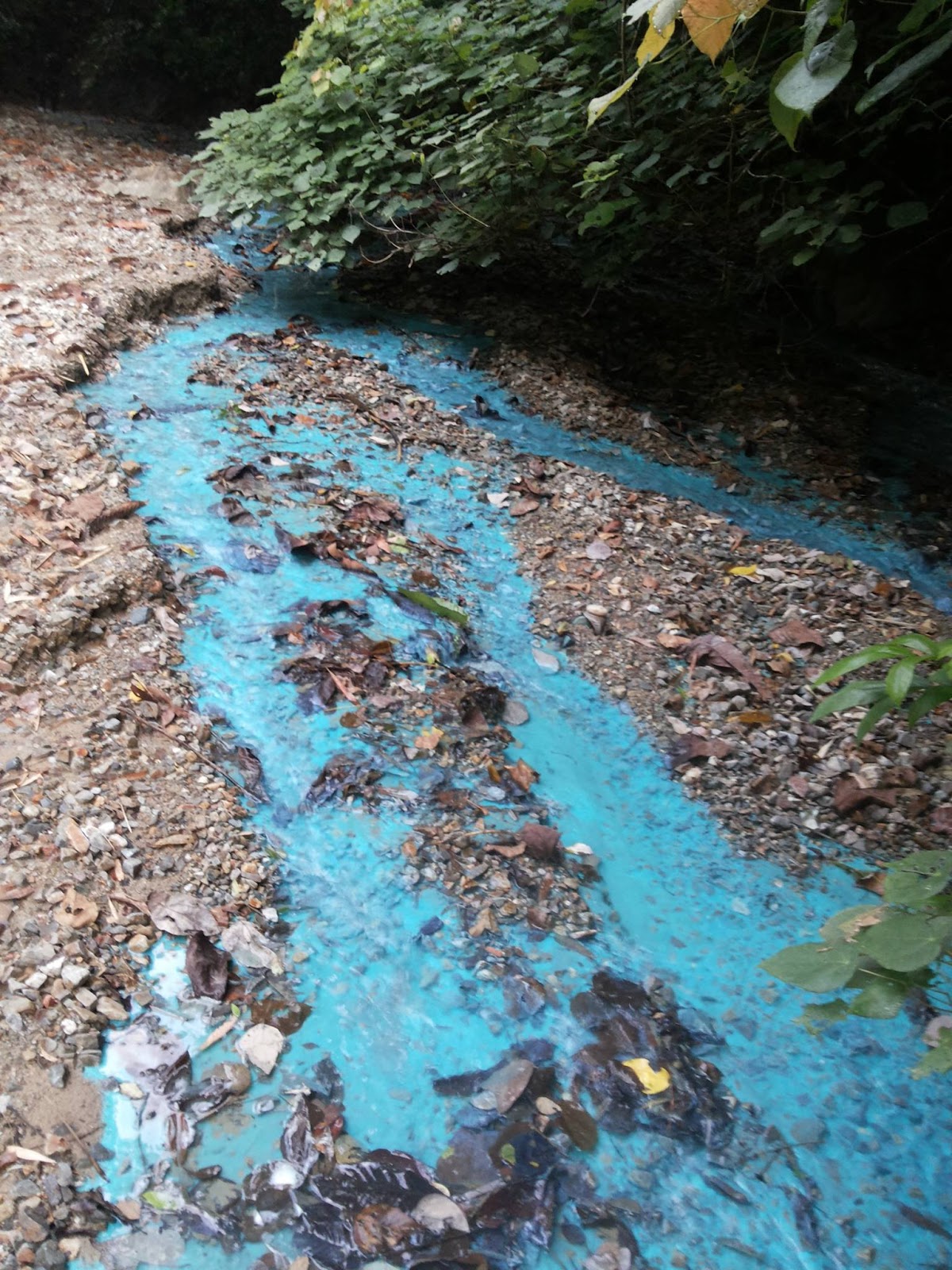
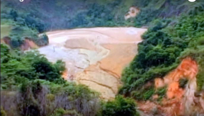
     Sixty six (66) years old, a native of Marinduque and a farmer by livelihood, Nanay Naty was the third plaintiff to testify in the case “Rita Natal et al. v. Marcopper Mining Corporation” filed at the Boac trial court, where almost 41 plaintiffs, most of whom are farmers, seek damage compensation from the defendant mining company. The root of this case is the disaster that struck on the 6th of December 1993, when a portion of the Maguila-guila Dam constructed by Marcopper, collapsed and released an overwhelming amount of silted and contaminated water that submerged and destroyed the plaintiffs’ properties, sources of livelihood, exposed them and their families to serious health risks, and virtually obliterated the Mogpog River, leaving it desolate and incapable of substantially supporting any life form. The complainants contend that they had suffered greatly and continue to suffer as a consequence of the company’s willful refusal to close the Maguila-guila Dam and rehabilitate the Mogpog River, which once supported many of their livelihood. Marcopper, on the other hand, denies the allegations of the plaintiffs and contends that the disaster was not caused by their negligence but by the battering of the typhoon “Monang” — allegedly an “act of God”, which led to the collapse of the Maguila-guila dam.


     For Nanay Naty who has resided since birth at the banks of the Mogpog River and has ever since depended on the river for her family’s daily food and water needs and for leisure, the 1993 incident was really a traumatic event that has caused and is still causing until now, indescribable anguish and indignation. Not only that the 1993 mining disaster annihilated her family’s crops and farm animals and caused severe damage to their house, but the collapse of the Maguila-guila Dam at around 3:00 in the morning of that fateful day had also put the very lives of Nanay Naty’s children in peril. She recalls that because of the intense flooding that had resulted from the collapse, she and her husband had been forced to tie their small children to some sturdy furniture so they would not be washed away by the raging waters. For Nanay Naty, this was indeed a traumatic event -- one that would keep playing in her mind whenever it would pour driving rain.


Part of Mogpog River. Acid mine draiage continuously flowing. Photo: Oxfam Australia

     Twenty-three years after the disaster, Nanay Naty still greatly abhors the Marcopper Mining Company and even claims that it has “raped” the once pristine island of Marinduque. The same sentiment is shared by the other plaintiffs in the case. This shared sentiment, however, was not the case during the late 1970s when Marcopper Mining Corporation was still just starting its activities. Back then, Nanay Naty and other residents were still celebrating the mining operations in their island because they believed that it would bring employment for fellow Marinduqueños and provide their province with more income that would eventually redound to the benefit of a greater number of people. The 1993 disaster, however, shattered this belief. They learned the bitter lesson that they would not want the same disaster to happen again where no one cleaned up the mess or brought back their rivers and environment to their former vitality. 

Today, Nanay Naty and her co-plaintiffs like Nanay Milagros Muhi are active campaigners against any other forms of mining within and outside their island. In fact, Nanay Naty, through the sponsorship of civil society groups, has already been to Baguio and Davao del Sur to share with the people in those places the heart-breaking tragedy that her family has suffered and the abominable environmental destruction caused Marinduque by mining in the island. This effort on the part of Nanay Naty, more than bringing listeners to tears, has moved and inspired them to take an active stance against mining within their respective provinces.
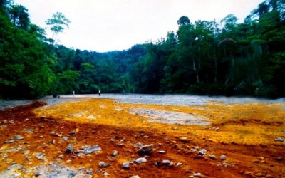
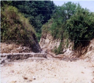
Mogpog field once flourished with palay and vegetables, now desolate

     As of now, even if it took fifteen years for the first hearing of the Natal case to commence from its filing in 2001, Nanay Naty, along with the other plaintiffs, is still hopeful that justice will be served to her family, the other affected families, and the environment of Marinduque. She hopes that even if she will not be able to live long enough to be compensated and witness the rehabilitation of the Mogpog River, her sons, daughters and grandchildren would nevertheless be compensated accordingly and see the revival of the river that has sustained many Marinduqueños for generations. She is comforted by the support of civil society organizations like the Marinduque Council for Environmental Concerns (MACEC), the Legal Rights and Natural Resources Center, Inc.-Kasama sa Kalikasan/ Friends of the Earth PH (LRC-KSKS/FOE PH) and defenders such as environmental lawyer Atty. Grizelda Mayo-Anda, who, she said, are unshakeable in helping them attain the justice that they and the environment of Marinduque deserve.    

     Today, Nanay Naty is thankful that her life and her family’s had been spared during the fateful event of December 6, 1993. She is convinced that after the said incident, she has had the mission to make Marcopper Mining Corporation accountable for all the purported destruction that it has caused in Marinduque, to spread the story of the mining disaster, and to strengthen the desire of the youth to continue the long battle against MMC and mining in general, in the pursuit of justice for the people and environment of Marinduque.

Friday, August 26, 2016

Quake epicenter is closer to Marcopper according to revised Phivolcs coordinates, tremor upgraded to M 3.2


San Antonio Pit (top left), Tapian Pit (south of San Antonio Pit) and epicenter of earthquake (pinned) form a triangle.

Phivolcs recorded an M 3.1 earthquake in Sta. Cruz, Marinduque on August 24, at 8:22:17 a.m. that has now been upgraded to magnitude 3.2. 

The Philippine Institute of Volcanology and Seismology also revised its coordinates for the epicenter of the earthquake which is now at 13.43°N, 122.02°E. The new coordinates show that the epicenter is much closer to the Marcopper mine site than previously thought (see above image). It could even be said that the epicenter is right in the danger zone (note triangulation)!

The Marcopper mine site keeps six dams, declared to be in various states of disrepair since the mine site was closed down and abandoned not long after the 1996 mine spill. Local and foreign scientific studies in 2004 have both confirmed that a catastrophic collapse of the dams could occur in the event of violent typhoons. 

Places downstream could be wiped out if any of the walls of the dams are badly ruptured. The effects of past landslides and flash-flooding are quite visible in many areas. (see previous post).

In recent years, devastating typhoons and flash flooding have already been experienced in most towns of Marinduque. But, authorities concerned have largely adopted a devil-may-care attitude with respect to safety and health issues.

It is largely believed here that collusion between certain people involved with the company and some government authorities concerned, including environmental agencies unable to undertake serious inspection and monitoring of the mine site danger zones, have merely succeeded in putting the people in limbo over the current state of the dangerous dams hanging over them. 

It is also largely believed that the continuing interest or obsession to pocket proceeds out of the remaining escrow funds originality intended for clean-up of Boac River, but believed to have been reverted back to the company, is the major obstacle that continues to clog the mind of those prone to corruption.

But concerned Marinduquenos are still hopeful that the needed national intervention in the matter of addressing the many environmental, health, livelihood and legal issues that emanated from the Marcopper disasters would finally be addressed by the Duterte administration.

Wednesday, August 24, 2016

M 3.1 tremor near the Marcopper mine site, DENR should rush to the scene to check/repair the dams


This is to inform the 'new' DENR because it's possible they don't know, that the Marcopper mine site sits on an earthquake fault. The breakage of the tunnel plug that caused our environmental misery in 1996 until today was blamed by the mining company to a magnitude 3.5 earthquake that occurred a week before the March 24, 1996 disaster. However, we the people knew that suspicious seepage from the Pit was already being complained about by the people of Boac six months prior to that and the arrogant company could hardly care in response.

Earlier today, Wednesday, August 24, 2016, there was a magnitude 3.1 tremor that shook the town of Sta. Cruz, Marinduque at 13.41 degrees N, 122,07 degrees E. It's a very shallow earthquake with depth of only 1 km! 

With the help of Google Earth I traced the location that appears to be so close to the perilous dams of Marcopper (above image). These abandoned dams had been declared in danger of collapse by scientists as early as 2004.

The uncontrolled flow of AMD from these dams since then, and new photos showing how these contaminated liquids and seepage are flowing into our rivers have been posted here since August 6. So far, nothing concrete has been undertaken by the DENR under a new Secretary to check the dams at least as a starter.

It is a valid question to ask if past and present earthquakes and violent typhoons have ruptured any of the walls of these dams. There are many, Maguila-guila Siltation Dam, San Antonio Pit, Bol River Dam, Tapian Pit, Lower Makulapnit Dam, and Upper Makulapnit Dam. We just cannot possibly be that lucky.


Voluminous releases of water from the mine site have occurred in the past, especially during severe storms. There are many so easy to blame them on just 'climate change' without independently checking the actual state of these dams. But that's apparently something the armed personnel guarding the mine site really wouldn't allow anyone to do for whatever justifiable reason. 

Then there's the strong probability that all previous official inspectors couldn't just get rid of their bureaucratic boredom after a lazy peek of the mine site and just report happily that 'nothing significant has happened', 'all is well'.

Do we have to wait for Boac or Mogpog to be wiped out first before insisting that credible action must really be done now?


Or shall we just suffer more of this?


December 2015 landslide at Mataas na Bayan by the Boac River. Photo: Raffy Garcia

Mining's permanent pollution

by Keith Slack 8/18/16


AMD in Mogpog, Marinduque, Philippines.

The environmental damage caused by mining often can’t be undone. And companies are trying hard to convince us otherwise.

The global mining industry spends tens of millions of dollars each year trying to convince us that it is “sustainable” and an indispensable part of the global economy, both now and in the future. There’s even an initiative to demonstrate mining’s ability to contribute to the UN’s Sustainable Development Goals.   

The truth is that mining presents major problems for development; including one that is not well-known outside mining-nerd circles: Pollution of ground and surface water “in perpetuity,” i.e. forever.

This is a globally pervasive and enormously costly problem. And the mining industry’s unwillingness to comprehensively address it undercuts nearly everything the industry says about sustainability.”  For developing countries, this permanent pollution represents an unresolvable financial burden that will drain away precious resources needed to address poverty and development.

A quick geology lesson:  the mining of hard rock minerals such as gold, silver and copper often exposes other rocks known as sulfides.  This exposure causes the rock to produce sulfuric acid that drains into the surface and ground water near mine sites. The acid generation process continues for thousands of years (i.e. “in perpetuity”).   

Rivers in Spain are still contaminated today by acid that began generation during Roman mining 2000 years ago. Once this contamination begins, it can’t effectively be stopped, only neutralized through the continual chemical treatment of the water. Water treatment of this type is extremely expensive; costing $67 billion per year in the US alone.

Environmental groups have long argued that mines requiring “perpetual water treatment” should simply not receive permits to operate.  The cost to communities, the environment, and to tax payers is simply too high.

In some countries, including the US, companies are required by law to put up financial sureties (e.g. bonds) to cover the costs of long-term water treatment. But the regulations are weak and clean-up cost estimates are often far below the actual costs. Not to mention, tracing legal responsibilities for rehabilitation over decades or even centuries can be extremely difficult if not impossible. In many countries in Latin America, Africa and Asia oversight of mining is weaker still.

Incredibly, some mining companies argue that they simply can’t operate mines without perpetual water treatment. They contend that banning it means banning mining. This issue is now one of the most contentious in efforts to finalize a global standard for “responsible” mining under the Initiative for Responsible Mining Assurance, which Oxfam helped get off the ground ten years ago. Experts with the Center for Science in Public Participation, a Montana-based group that works with mining-affected communities, argue that mining companies can, using existing technology,  know with a reasonable degree of certainty whether their mines will be acid-generating.  If they are, the companies could look for a different ore body to mine.

Located five kilometers from the Spanish border, the Portuguese São Domingos mine, abandoned since 1966, continues to pollute the river ways that flow into Chanza dam, the largest drinking water reservoir in the province of Huelva, according to scientists. The new study shows that oxidation and the dissolving of sulfurs are processes that remain active today

For communities around the world, especially rural agricultural communities in developing countries, water is the essential resource that makes their lives and livelihoods possible. Women in particular suffer from the effects of contaminated water.  No amount of fancy industry PR or high-sounding principles can make mining “sustainable” if mines are generating pollution that will permanently destroy communities’ access to this life-sustaining necessity.  To provide a graphic depiction of the risks communities face, Oxfam is finalizing a mapping of rural agricultural areas in Honduras that are potentially impacted by mining-contaminated water.

Mining companies should commit now to avoiding beginning activities in places that will generate acid and forever destroy water systems.  This is especially true in developing countries that lack the capacity and political will to hold companies accountable for long-term clean-up. In the US, efforts have been made to address this issue through reforming the antiquated 1872 Mining Law. These should be supported.  Financing institutions like the World Bank, which invests in mining projects, should require its clients to demonstrate that their projects will not require perpetual water treatment. And sustainability dialogues like those around the Sustainable Development Goals should make avoiding perpetual water treatment part of their operational plans.

Anything less is just pouring (contaminated) water down the drain.

Tuesday, August 23, 2016

Rep, Velasco and DENR meet on Marinduque plans; Bol River blues

Rep. Velasco and DENR talks


Cong. Velasco with DENR officials during preliminary talks August 18.

Very recently, Marinduque Rep. Lord Allan Velasco posted in his Facebook page that he had a working lunch with DENR officials to discuss, among others, the Marcopper situation in the province, "about the problem with the structure of the dams and monitoring systems to be in place and also the supposed leak in the river". He adds that these are "preliminary talks with the DENR and would be meeting with the DENR secretary soonest”.

I suppose that the "supposed leak in the river" has to do with several inspections made by the municipal planning and development coordinator of the municipal government of Boac, Engr. Luna "Pongkoy" Manrique, many photos of which have also been published here along with Luna's observations/remarks.

I am, honestly, very wary of DENR 'monitoring'. We have a well-respected crusader of a lady, yes, Sec. Gina Lopez, familiar to many environmental advocates in this province. Surely she is one lady also very familiar with the historic Marinduque issues, both environmental and legal, and knows how and why this island-province has become "the poster child for irresponsible mining, past and present".

But the unrealiability of DENR or MGB inspections and monitoring reports during the past decade, at least, stems from the fact that such reports are not properly disclosed to the public. A quick look at two of such reports (here and here), that have surfaced in the Internet seems only to clearly show unwillingness to tie-up such official inspections with the serious and painstaking scientific findings, observations and recommendations made separately by various local scientists and a foreign 'independent' team (USGS). 

What if the same shuffled or reshuffled agency people on the ground are still running the show, those who have become corrupted by what had hounded this Marcopper problem over decades - plain treachery and dictated deception when it pertains to ongoing legal cases/issues, and non-disclosure of reports. be they serious ones or 'rubber-stamp' ones, when the topic is about health and safety issues?

Well, good luck to our beloved Marinduque Congressman!


On top is the San Antonio Pit, in the middle is the Bol River Dam, below is the Tapian Pit. Bol River runs from north to south converging with Makulapnit River, finally to Boac River. Even Google maps don't lie about the awful degradation of that mine site above our heads.

But going back to the dam structures and "supposed leak in the river" problems, my posts on Engr. Luna's discovery and the discovery by our local boys of that "blue river" near Brgy. Puting Buhangin (they simply refer to it as "ilog sa Puting Buhangin" or others calling it "sapa sa Puting Buhangin", because no native Boakeno seems to have known about any "Bol River sa Boac", and thus escaped the rightfully needed attention for years),  the Engineer points to Bol River Dam as source of the AMD. 

Then new maps evidently pinpoint the Bol River which is really one and the same as the native Boakeno's 'Puting Buhangin River'.

To contain this confusion, I find it apt to focus more on Bol River Dam/Bol River, and was able to dig up even more pertinent data from several sources, collated below. Maybe the new DENR wouldn't mind at all being informed also about something that had escaped everyone's attention?

After all, we Marinduquenos are quite used to being exploited no end by DENR. Like it would promise to take action on things they couldn't possibly do then, even announcing before the world what those options were. Probably believing that people forget what they say anyway or don't take them serously.


Part of what had appeared in a DENR powerpoint presentation, Responsible Mining for Sustainable Development, under the section, Implementing Responsible Mining in the Philippines. Presented in various forums pero plain 'wish ko lang' pala.

Bol River blues: No room for denials this time please

Unchecked, uncontrolled discharge of Acid Mine Drainage (AMD, also known as Acid Rock Drainage), from the Marcopper mine site accumulated over time poses significant environmental risk on downstream rivers. In addition, adverse effects from one or more toxic heavy metals are bound to occur in people residing in areas where such uncontrolled discharge are taking place and where there are mine tailings nearby.

Turns out through further research that numerous studies have already been undertaken by scientists in agreement with these scientific facts.

Turns out also that local scientists have been critical of the costly 'independent' study, earlier posted here, on some major questions. For this reason, this special post will just underline conclusions these scientists, both local and foreign, were in agreement with and on findings they have already supported - focusing specifically on the AMD contamination of Bol River flowing into Boac.

More serious, AMD from mine site far exceeds 1996 damage

We know that there are extensive deposits buried in the Makulapnit and Boac riverbeds and lying exposed on the river banks. However, it may come as a shock that more serious than the environmental damage caused by the 1996 tailings spill is the ongoing acid mine drainage emanating from the mine site. The experts had said so in no uncertain terms.


Part of their official findings are that:

- The environmental damage caused by these (1996 mine spill), is far exceeded by the acid rock drainage emanating from the Marcopper site.

- There is acid rock drainage from the Tapian Pit overflow and from the mine waste piles into the Makulapnit, Bol, and Maguila-guila rivers.

- There is continuing erosion of mine wastes into the siltation impoundments on the Makulapnit, Bol and Maguila-guila Rivers. 

The Tapian Pit-Bol River connection

Mt. Tapian is a prominent peak in the central part of Marinduque with an elevation of 698 meters above mean sea level and is the site of the copper deposit in the rugged, precipitous and hilly sections west of this mountain.

The main drainage system in the mine site, the Bol and Maculapnit rivers, flow westward. All streams empty into the Boac River which is the master drainage in the province.

So what have they already found out about our main subject, the Bol River?

The Bol River Reservoir which receives surface and possibly ground waters from the Tapian pit and other waste dumps shows a green tint, suggesting elevated levels of copper (Plumlee et al. 2000).


Sediments are also flowing from the northern San Antonio Pit dumps directly into Bol River as the above USGS photos clearly show, captioned:  A). Acidic, copper rich puddles form on waste dumps after rains. B). The deep green color of the Bol River Reservoir waters indicate high copper content.

The USGS second study in 2004 confirmed that fluctuating or rapidly rising water levels may compromise the stability of the Tapian pit east highwall. The only drainage for Tapian pit, which is 310 Tunnel, (directed to the Bol River), is inadequate for emergency drainage should water levels rise during typhoons, according to the said study.

Continuous discharge affecting people's health, ecosystems

Toxic wastes are continuously being discharged through sedimentation at erosion, and are contaminating the soils, water ways, air and are affecting people’s health, livelihood, and various ecosystems.  

• Benthic macro invertebrates are disappearing or have disappeared in the Mogpog and Bol rivers.

What was considered warranted more than 10 years ago as short-term solution then?

• Installation of weirs at the outlet portal of the diversion tunnel of the Bol River Dam and clearing-out of obstructions to the spillway.

This Tapian Pit-Bol River direct connection is further confirmed very briefly in an MGB monitoring report (2006):

Tunnel 310: Water is flowing freely from the Tapian pit towards Bol River and finally to Boac River, preventing the build-up of water at this pit. (MGB October 2006)


People, just be aware of this mysterious Tapian Pit Tunnel 310 towards Bol River!

Latest study on Bol River heavy metal contamination

The connection between these two bodies of water could also be found in a study as recent as two years ago published in the Philippine Science Letters (November 2014), that confirmed thus:

"The pH of and the concentrations of heavy metals in Bol River Reservoir and Tapian Pit are shown in Table 9. It is evident that the water samples from these sources were acidic and were contaminated with elevated levels of copper. In addition, the samples also contained iron and zinc in significant concentrations."


Many concerned Marinduquenos would be very happy then to see specific action being undertaken by the new DENR on the Bol River problem, as a prelude to DENR Secretary Gina Lopez and the entire department addressing the herculean task of responding to all Marcopper-related issues, past and present.

You know, start the Bol rolling, the Bol is in your court...


Just now. Photo from Engr. Luna Manrique

Meanwhile, the rest of Cong. Velasco's list discussed during preliminary talks with DENR officials were as follows:

1. Setting up of marine reserves;
2. Planting of a certain species of mangrove that attracts fireflies to replicate the firefly tours in Iwahig, Palawan and in Donsol, Sorsogon;
3. Establishment of a bamboo park;
4. Solution to the Marcopper road going up to District 6 of Sta. Cruz;
5. Setting up of dive sites around the province;
6. Discussed about the problem with the structure of the dam and monitoring systems to be in place and also the supposed leak in the river, and;
7. Development of Calancan Bay into ecotourism area.

Sunday, August 21, 2016

The never-ending curse of Marcopper, in DENR's court now

Taken August 17, 2016, with Philippine newspaper issue of August 16 as date mark.
All photos courtesy of Engr. Luna "Pongkoy" Manrique.

Engr. Luna Manrique, MPDC of Boac's post 8/20/16:
"IT'S NOT OVER YET Abandoned Marcopper Mine Site Continues to Pollute Boac River up to this date.
"I requested the Army Cafgu to patrol the area last August 17, 2016 and take pictures with GPS Reading. The newspaper they used as date mark was issued only last August 16, 2016.
"Leaving the mining site without cleaning up the remaining mining waste and polluted sediment, and without taking appropriate measures to stop the flow of acid mine drainage from the basins and ditches left behind is very irresponsible act of the mining company. “Until the ongoing pollution at the MARCOPPER Mine site is adequately addressed, it continues to pose a threat to water quality, and the communities and wildlife in the area that depend on clean water.” I had already informed the DENR on this matter and we are waiting for their team to inspect the area." - Pongkoy MG Panther Manrique, Boac MPDC

No, definitely it's not over and may not be over still for quite sometime. For who could even grasp the magnitude of such a high form of deception committed against the people of Marinduque when the study that cost P20-million to identify issues on the environment, health and engineering, was deliberately hidden from scrutiny of the same people whose lives are directly affected and/or endangered? 

We the people were simply 'kept in the dark', (a phrase that has characterized these issues since the beginning of time), that we really had no inkling on the seriousness of the situation, what has been happening, and other safety and health concerns that ever confronted us yesterday, today and tomorrow!

It is quite revealing that the MPDC of Boac, Engr. Luna Manrique, who is obviously very knowledgeable on this subject as compared to us ordinary citizens, would express his disgust and surprise that nothing has been done to stop the flow of acid mine drainage from the basins and ditches left behind. That's simply because of the fact that these issues and concerns were never properly presented to us, Marinduquenos all this time.


The only conclusion one could arrive at with new facts coming to the fore is that while we were praying for the dams not to collapse with images in our mind of people drowning, screaming, we were just being more evilly killed slowly, slowly pala all this time with the continued acid mine drainage overflow coming from those pits of hell. We were just slowly and surely being covered with those waste dump piles spread in the vast expanse of the Marcopper site continuously flowing into our rivers and into our water. 

And we're not talking here about the millions of cubic meters of tailing that have already remained embedded into our rivers and shores. This is what the scientists warned us about in 2004 that only the very powerful apparently knew and just kept to themselves.


Again, as previously posted here, the 2004 study of the Independent Assessment Team that was maliciously hidden from public scrutiny and discussion, already emphasized the need to immediately address two specific items:
1). Acid-rock drainage from the Tapian Pit overflow and from mine waste piles into the Makulapnit, Bol and Maguila-guila rivers, and
2) Erosion of mine wastes into the siltation impoundments on the Makulapnit, Bol, and Maguila-guila Rivers.
Further, they merely added that potentially imminent failures of the Makulapnit, Bol, and/or Maguila-guila Siltation Dams, coupled with the continued large-scale erosion of mine wastes into the siltation impoundments behind the dams, increases the likelihood of potentially catastrophic releases of large volumes of mineralized, acid-generating mine wastes into the Makulapnit, Bol and Maguila-guila rivers. These releases according to them would be similar to the release that occurred in 1993 from the failure of the Maguila-guila silltation dam.

With the kind of flash floods that have hounded our barangays over the years, heavy landslides during severe flooding along the path of the Boac river system, the contamination of our water with toxins and untold health related concerns confronting our people, only the hopeless deniers bent on controlling their hapless victims would claim that all these have anything to do with the current state of abandonment of the mine site and its structures, two-decades long now. That all these have nothing to do with the practice of deliberately keeping our people uninformed. Ignorance is bliss, they'd only mockingly mutter.

The ball's in your court now, the new DENR. No more superficial moro-moro inspections and monitoring please that only succeed in avoiding to touch these very clear and unmistakable issues!

Thursday, August 18, 2016

Kumpirmado ng mga siyentipiko ang pagdaloy ng AMD sa Bol River, tinagong report, pagguho ng mga dam

 Ang itinagong final report ng Independent Assessment Team, Mining Impacts on Marinduque

Dahil nga sumablay ang engineering designs para sa mga estruktura ng minahan, tulad ng naganap noong 1993 sa Mogpog sa failure ng Maguilaguila siltation impoundment na kung saan rumagasa ang mga debris na nagdadala ng acid generating mine waste sa Mogpog River, at ang pagiging sablay din ng Tapian drainage tunnel noong 1996 na nagresulta sa pagragasa ng tailings sa Makulapnit at Boac Rivers, nagresulta ang mga ito ng malawakang pagkasira sa kapaligiran ng Marinduque. 


Walang karampatang tulong mula sa kinauukulan sa pagremedyo sa Mogpog River o mapigilan ang pagkalat pa ng lasong mina. Minsan, nagtulong-tulong na lamang ang mga residente para ma-kontrol kahit papaano ang pagkalat ng lasong mina. Photo: MACEC 

Hindi pa kasama rito ang ginawang pag-pollute ng Calancan Bay at mga sakit na dinanas ng mga residente hanggang ngayon, lalo na ng mga kabataan.

Mula ng hininto ang operasyon ng minahan at tumakas palabas ng bansa ang mga banyagang nasa iikod ng pagpapatakbo ng minahan ay wala nang ginawang pagpapaayos sa mga peligrosong esktruktura o dams ng minahan.

Dahil dito, walang tigil, araw at gabi, ang pagdaloy ng acid mine drainage mula sa mine waste dumps at sa Tapian pit lake, mula sa tailings deposits, ganun din sa large-scale erosions ng mine wastes mula sa malalawak na mine waste piles sa minahan.

Ang mga nabanggit sa itaas ay isang bahagi lamang ng isinagawang imbestigasyon, pag-aaral at konklusyon ng Independent Assessment Team ng USGS noong 2003 (natapos 2004).

Findings ng dalawang scientific teams

Kinumpirma ng mga siyentipiko ng USGS ang naunang pag-aaral na isinagawa ng Klohn-Crippen noong 2001. At batay sa pagsusuri ng USGS Independent Assessment Team, idiin nila ang mga serious deficiencies at kanilang pagkabahala sa apat na major impoundments (dams) sa minahan.

Mga usaping pangkaligtasan ang nakita nila na dapat daw tugunan sa Tapian Drainage Tunnel Bulkhead, Tapian Pit at East Highwall, at sa 310 Drainage Tunnel.

Mayroon pa rin pala silang short-term recommendations na inilatag, gayundin ang long-term recommendations hinggil sa mga peligrong ito. 'Paramount concern' nila ang kaligtasan at magiging kalagayan ng mga maapektuhang komunidad at ito ay binigyang diin ng Team.

Idiniin nila na mabilis daw namang magagawa ang kanilang mga rekomendasyon para sa short-term na hindi naman kalakihan ang magagastos.

Para sa long-term recommendations naman, ito raw ay mangangailangan ng mas malaking pananalapi. Inihayag ng Team na ang kanilang rekomendasyon ay ibinibigay nila bilang options para makagawa anila ng informed decisions ang mga stakeholders at policy makers kung paanong matutugunan ang potential safety concerns na may kinalaman sa mga estruktura, gayundin ang pinal na desisyon na gagawin sa mga impoundments at pits.


Ganito ang caption ng USGS sa mga larawan sa itaas: A. Acidic, copper rich puddles form on waste dumps after rains. B. The deep green color of the Bol River Reservoir waters indicate high copper content
.

Hindi ipinaalam sa mga tao

Hindi inilapit, ipinaalam o inilatag sa mga stakeholders o mamamayan ang alin man sa mga rekomendasyong nabanggit. Nasayang lamang ang ginastos ng Malacanang at ipinatupad ng Kapitolyo na P20-million dahil tila pagka-sumite ng nasabing report na ang titulo ay Mining Impacts on Marinduque, Engineering, Health and Environmental Issues - Final Report of the Independent Assessment Team (2004) ay tila doon na rin nagtapos ang istorya.

Kung bubusisiin ang nasabing Final Report, mayroong mga ilang 'most pressing problems at Marcopper that are causing the greatest adverse environmental impacts on the surrounding waters', ayon sa Independent Assessment Team. At ito ay talagang kagulat-gulat.

Kagulat-gulat dahil naganap na at patuloy na nagaganap pa ang kanilang pinangambahan. Iyong sitwasyon sa Maguila-guila dam/river ay maaring hindi na lingid sa mga taga-Mogpog, pero yung sitwasyon sa Makulapnit ay hindi batid ng taumbayan. Kampante dahil sa paniguro ng mga magagaling na OK na ang Boac River.

Lalong hindi natin alam yung walang humpay na pagdaloy ng acid-mine drainage sa Bol River na sa hindi inaasahang pagdiskubre kamakailan at pagkabighani ng mga kabataan (maraming salamat sa kanila), dahil sa kulay nito (cloudy blue/dark green) ay inakala nilang "busilak" - kaya't sa tuwa nila ay ibinahagi sa Facebook ang mga larawan ng kanilang paliligo, pagtatampisaw at pag-dive sa ilog na ito.


Hindi pala busilak kundi toxic/acidic kaya blue.
Photo: Jhonny Pereda

Nalaman tuloy natin ang tila inilihim na existence at seryosong sitwasyon ng Bol River. Hindi nga nagkabula ang aking naunang sapantaha.

Lumabas, ayon sa aking hindi naging madaling paghahanap at pananaliksik nitong mga huling araw, na noon pa pala (2004), naitala ng Team ang kanilang nadiskubre at pagkabahala sa Bol River. 

Tinago nga lamang ng mga kinauukulan, at kahinahinalang hindi ito ipinaalam sa bayan.

Ito ay ang mga sumusunod ayon mismo sa Independent Assessment Team:


1). Acid-rock drainage from the Tapian Pit overflow and from mine waste piles into the Makulapnit, Bol and Maguila-guila rivers, and

2) Erosion of mine wastes into the siltation impoundments on the Makulapnit, Bol, and Maguila-guila Rivers. The Maguila-guila impoundment is currently filled and allowing mineralized sediment to flow directly into the Mogpog River system, and mine wastes from the central portions of the mine site are flowing unchecked into the Bol River.  

Although the lower Makulapnit siltation impoundment is still trapping eroded mine wastes, it appears that, given sufficient time, it will eventually fill completely, allowing mine wastes to then flow unchecked from the south side of the mine site into the Makulapnit River.

Further, the potentially imminent failures (as identified by the Engineering Team) of the Makulapnit, Bol, and/or Maguila-guila Siltation Dams, coupled with the continued large-scale erosion of mine wastes into the siltation impoundments behind the dams, increases the likelihood of potentially catastrophic releases of large volumes of mineralized, acid-generating mine wastes into the Makulapnit, Bol and Maguila-guila rivers, similar to the release that occurred in 1993 from the failure of the Maguila-guila siltation dam.


Abnormalidad ng mga baha, pagguho ng matataas na lugar

Haka-haka bang maituturing ang abnormalidad na ng mga bahang nagaganap sa ating mga bayan kapag may bagyo o tuloy-tuloy na pag-ulan? Kasama na ang pagguho ng dantaon nang matataas na lugar na nasasaksihan ngayon ng ating mga mata?

Malayo ba sa katotohanan ang magpasya na dahil nga 'unchecked', walang control ang pagdaloy ng AMD sa ating mga ilog ay marami nang mumunting pagkasira at pagguho ng mga impoundments (dams) ang naganap noong mga nakaraang bagyo? Suwerte nga lamang natin dahil ang pagdaloy ng baha mula sa itaas ay tila dahan-dahan subalit malawak at nagmumula sa hindi matanaw na kalawakan ng mga apektadong lugar sa minahan? 

Pero hindi tayo masuwerte dahil sa hindi nahaharang na pagdaloy ng mga lasong-mina sa ating mga ilog araw-araw, gabi-gabi lalo na kapag may bagyo. Hindi tayo masuwerte dahil hindi rin pinag-ukulan ng sapat na pansin kung ano talaga ang tunay na sanhi ng paglamon ng ilog sa mga matataas na lugar sa Boac.


Dala marahil sa hindi pagsasapubliko ng final report ng Independent Assessment Team, tila walang nag-uugnay sa pag-guhong naganap sa Mataas-na-Bayan, Boac bilang indikasyon ng dam failure o 'release of large volumes of mineralized waste'. 
Taken December 2015 after Typhoon Nonah. Photo: Raffy Garcia

Para sa mga siyentipikong gumawa ng assessment, ang 'imminent failures' ng Makulapnit, Bol at Maguila-guila Siltation Dams, idagdag pa anila ang patuloy na malakihang pagguho ng mine wastes sa mga siltation impoundments sa likod ng mga dam, ang maaring maging sanhi ng 'potentially catastrophic releases' ng malalaking volumes ng mineralisado, maasidong lasong-mina sa mga nasabing ilog, na hindi malayo sa naganap na sa Mogpog noong 1993, ayon sa Team.

Mga realidad

Sa loob ng 20 taon ay nagkaroon na tayo ng limang presidente, hindi mabilang na DENR secretaries at mas lalong hindi mabilang na mga direktor ng Mines and Geosciences Bureau. Sa mga ahensya ng gobyerno, kapag may bagong pinuno, maaaring hindi na makita (dahil sa anumang kadahilanan), ang mga dating mas mahahalagang reports o mga dokumento na magbibigay-linaw o higit na makakatulong sa kanila para makapagpasya. 

Kaya't palaging nagsisimula ulit sa panibagong pagtatasa o imbestigasyon o umasa lamang sa mga impresyon at "feelings".

Mas masaklap na may mga taong hiyang na hiyang sa ganitong sistema dahil maaring nagagawa nilang manipulahin ang mga desisyon o kawalan ng desisyon, saan man sila makakakuha ng pansariling ganansiya.


Turn-over to new DENR sec Gina Lopez by old DENR sec Ramon Paje.
Photo: MB

Sampol yung $12-Million Escrow

Isang maliwanag na ehemplo na lamang yung $12-Million - $13-Million na inilagak ng Placer-Dome bilang escrow fund para magamit sa pagpapalinis ng Boac River. Matapos makumpirna ito ng mga nasa katungkulan, kasama na ang minahan at DENR, biglang walang alam daw ang DENR tungkol dito. 

Pinangalandakan naman ng abogado ng Marinduque na ang escrow raw ay isang alamat at walang ganung salaping magagamit para maayos ang kinasapitan ng ilog. 

Sa huli ay nadulas ang isa pang abogado ng lalawigan sa pakikipag-usap sa stakeholders at inamin na kasama na raw ang halagang iyon sa alok ng Barrick. Sa mga pribadong pulong naman kasama ang mga opisyal ng lalawigan ay hindi pala inilihim na kasama nga ang escrow doon sa alok at nagdagdag na lamang pala ng kaunting halaga ang kumpanya para maging $20-Million.

Mabuti na lamang at naunawaan ng mga Marinduqueno ang panglilinlang na ginagawa sa kanila, kayat may puwersa ang matinding pagtanggi sa imoral na alok.


Kuha sa Gasan sa pagbisita ni DU30. Photo: Dahlia N. Itturalde

May bagong pag-asa baga?

Maraming naniniwala na may bagong pag-asa dahil mismong ang bagong Pangulong Rodrigo Duterte sa isang pahayag sa telebisyon ay mismong nagbanggit ng tungkol sa sinapit ng ating islang-lalawigan sa kamay ng iresponsableng pagmimina. Maraming naniniwala na may magaganap na makabubuti para sa mga Marinduqueno at higit na ikapapasalamat ito ng mga kalipunang sibil na walang tigil sa kanilang ipinaglalaban para sa kalikasan at para sa tao. 

Sana nga, sa  wakas.

Kumpirmado ng mga siyentipiko ang pagdaloy ng AMD sa Bol River, tinagong report, pagguho ng mga dam

 Ang itinagong final report ng Independent Assessment Team, Mining Impacts on Marinduque

Dahil nga sumablay ang engineering designs para sa mga estruktura ng minahan, tulad ng naganap noong 1993 sa Mogpog sa failure ng Maguilaguila siltation impoundment na kung saan rumagasa ang mga debris na nagdadala ng acid generating mine waste sa Mogpog River, at ang pagiging sablay din ng Tapian drainage tunnel noong 1996 na nagresulta sa pagragasa ng tailings sa Makulapnit at Boac Rivers, nagresulta ang mga ito ng malawakang pagkasira sa kapaligiran ng Marinduque. 


Walang karampatang tulong mula sa kinauukulan sa pagremedyo sa Mogpog River o mapigilan ang pagkalat pa ng lasong mina. Minsan, nagtulong-tulong na lamang ang mga residente para ma-kontrol kahit papaano ang pagkalat ng lasong mina. Photo: MACEC 

Hindi pa kasama rito ang ginawang pag-pollute ng Calancan Bay at mga sakit na dinanas ng mga residente hanggang ngayon, lalo na ng mga kabataan.

Mula ng hininto ang operasyon ng minahan at tumakas palabas ng bansa ang mga banyagang nasa iikod ng pagpapatakbo ng minahan ay wala nang ginawang pagpapaayos sa mga peligrosong esktruktura o dams ng minahan.

Dahil dito, walang tigil, araw at gabi, ang pagdaloy ng acid mine drainage mula sa mine waste dumps at sa Tapian pit lake, mula sa tailings deposits, ganun din sa large-scale erosions ng mine wastes mula sa malalawak na mine waste piles sa minahan.

Ang mga nabanggit sa itaas ay isang bahagi lamang ng isinagawang imbestigasyon, pag-aaral at konklusyon ng Independent Assessment Team ng USGS noong 2003 (natapos 2004).

Findings ng dalawang scientific teams

Kinumpirma ng mga siyentipiko ng USGS ang naunang pag-aaral na isinagawa ng Klohn-Crippen noong 2001. At batay sa pagsusuri ng USGS Independent Assessment Team, idiin nila ang mga serious deficiencies at kanilang pagkabahala sa apat na major impoundments (dams) sa minahan.

Mga usaping pangkaligtasan ang nakita nila na dapat daw tugunan sa Tapian Drainage Tunnel Bulkhead, Tapian Pit at East Highwall, at sa 310 Drainage Tunnel.

Mayroon pa rin pala silang short-term recommendations na inilatag, gayundin ang long-term recommendations hinggil sa mga peligrong ito. 'Paramount concern' nila ang kaligtasan at magiging kalagayan ng mga maapektuhang komunidad at ito ay binigyang diin ng Team.

Idiniin nila na mabilis daw namang magagawa ang kanilang mga rekomendasyon para sa short-term na hindi naman kalakihan ang magagastos.

Para sa long-term recommendations naman, ito raw ay mangangailangan ng mas malaking pananalapi. Inihayag ng Team na ang kanilang rekomendasyon ay ibinibigay nila bilang options para makagawa anila ng informed decisions ang mga stakeholders at policy makers kung paanong matutugunan ang potential safety concerns na may kinalaman sa mga estruktura, gayundin ang pinal na desisyon na gagawin sa mga impoundments at pits.

Hindi ipinaalam sa mga tao

Hindi inilapit, ipinaalam o inilatag sa mga stakeholders o mamamayan ang alin man sa mga rekomendasyong nabanggit. Nasayang lamang ang ginastos ng Malacanang at ipinatupad ng Kapitolyo na P20-million dahil tila pagka-sumite ng nasabing report na ang titulo ay Mining Impacts on Marinduque, Engineering, Health and Environmental Issues - Final Report of the Independent Assessment Team (2004) ay tila doon na rin nagtapos ang istorya.

Kung bubusisiin ang nasabing Final Report, mayroong mga ilang 'most pressing problems at Marcopper that are causing the greatest adverse environmental impacts on the surrounding waters', ayon sa Independent Assessment Team. At ito ay talagang kagulat-gulat.

Kagulat-gulat dahil naganap na at patuloy na nagaganap pa ang kanilang pinangambahan. Iyong sitwasyon sa Maguila-guila dam/river ay maaring hindi na lingid sa mga taga-Mogpog, pero yung sitwasyon sa Makulapnit ay hindi batid ng taumbayan. Kampante dahil sa paniguro ng mga magagaling na OK na ang Boac River.

Lalong hindi natin alam yung walang humpay na pagdaloy ng acid-mine drainage sa Bol River na sa hindi inaasahang pagdiskubre kamakailan at pagkabighani ng mga kabataan (maraming salamat sa kanila), dahil sa kulay nito (cloudy blue/dark green) ay inakala nilang "busilak" - kaya't sa tuwa nila ay ibinahagi sa Facebook ang mga larawan ng kanilang paliligo, pagtatampisaw at pag-dive sa ilog na ito.


Hindi pala busilak kundi toxic/acidic kaya blue.
Photo: Jhonny Pereda

Nalaman tuloy natin ang tila inilihim na existence at seryosong sitwasyon ng Bol River. Hindi nga nagkabula ang aking naunang sapantaha.

Lumabas, ayon sa aking hindi naging madaling paghahanap at pananaliksik nitong mga huling araw, na noon pa pala (2004), naitala ng Team ang kanilang nadiskubre at pagkabahala sa Bol River. 

Tinago nga lamang ng mga kinauukulan, at kahinahinalang hindi ito ipinaalam sa bayan.

Ito ay ang mga sumusunod ayon mismo sa Independent Assessment Team:


1). Acid-rock drainage from the Tapian Pit overflow and from mine waste piles into the Makulapnit, Bol and Maguila-guila rivers, and

2) Erosion of mine wastes into the siltation impoundments on the Makulapnit, Bol, and Maguila-guila Rivers. The Maguila-guila impoundment is currently filled and allowing mineralized sediment to flow directly into the Mogpog River system, and mine wastes from the central portions of the mine site are flowing unchecked into the Bol River.  

Although the lower Makulapnit siltation impoundment is still trapping eroded mine wastes, it appears that, given sufficient time, it will eventually fill completely, allowing mine wastes to then flow unchecked from the south side of the mine site into the Makulapnit River.

Further, the potentially imminent failures (as identified by the Engineering Team) of the Makulapnit, Bol, and/or Maguila-guila Siltation Dams, coupled with the continued large-scale erosion of mine wastes into the siltation impoundments behind the dams, increases the likelihood of potentially catastrophic releases of large volumes of mineralized, acid-generating mine wastes into the Makulapnit, Bol and Maguila-guila rivers, similar to the release that occurred in 1993 from the failure of the Maguila-guila siltation dam.


Abnormalidad ng mga baha, pagguho ng matataas na lugar

Haka-haka bang maituturing ang abnormalidad na ng mga bahang nagaganap sa ating mga bayan kapag may bagyo o tuloy-tuloy na pag-ulan? Kasama na ang pagguho ng dantaon nang matataas na lugar na nasasaksihan ngayon ng ating mga mata?

Malayo ba sa katotohanan ang magpasya na dahil nga 'unchecked', walang control ang pagdaloy ng AMD sa ating mga ilog ay marami nang mumunting pagkasira at pagguho ng mga impoundments (dams) ang naganap noong mga nakaraang bagyo? Suwerte nga lamang natin dahil ang pagdaloy ng baha mula sa itaas ay tila dahan-dahan subalit malawak at nagmumula sa hindi matanaw na kalawakan ng mga apektadong lugar sa minahan? 

Pero hindi tayo masuwerte dahil sa hindi nahaharang na pagdaloy ng mga lasong-mina sa ating mga ilog araw-araw, gabi-gabi lalo na kapag may bagyo. Hindi tayo masuwerte dahil hindi rin pinag-ukulan ng sapat na pansin kung ano talaga ang tunay na sanhi ng paglamon ng ilog sa mga matataas na lugar sa Boac.


Dala marahil sa hindi pagsasapubliko ng final report ng Independent Assessment Team, tila walang nag-uugnay sa pag-guhong naganap sa Mataas-na-Bayan, Boac bilang indikasyon ng dam failure o 'release of large volumes of mineralized waste'. 
Taken December 2015 after Typhoon Nonah. Photo: Raffy Garcia

Para sa mga siyentipikong gumawa ng assessment, ang 'imminent failures' ng Makulapnit, Bol at Maguila-guila Siltation Dams, idagdag pa anila ang patuloy na malakihang pagguho ng mine wastes sa mga siltation impoundments sa likod ng mga dam, ang maaring maging sanhi ng 'potentially catastrophic releases' ng malalaking volumes ng mineralisado, maasidong lasong-mina sa mga nasabing ilog, na hindi malayo sa naganap na sa Mogpog noong 1993, ayon sa Team.

Mga realidad

Sa loob ng 20 taon ay nagkaroon na tayo ng limang presidente, hindi mabilang na DENR secretaries at mas lalong hindi mabilang na mga direktor ng Mines and Geosciences Bureau. Sa mga ahensya ng gobyerno, kapag may bagong pinuno, maaaring hindi na makita (dahil sa anumang kadahilanan), ang mga dating mas mahahalagang reports o mga dokumento na magbibigay-linaw o higit na makakatulong sa kanila para makapagpasya. 

Kaya't palaging nagsisimula ulit sa panibagong pagtatasa o imbestigasyon o umasa lamang sa mga impresyon at "feelings".

Mas masaklap na may mga taong hiyang na hiyang sa ganitong sistema dahil maaring nagagawa nilang manipulahin ang mga desisyon o kawalan ng desisyon, saan man sila makakakuha ng pansariling ganansiya.


Turn-over to new DENR sec Gina Lopez by old DENR sec Ramon Paje.
Photo: MB

Sampol yung $12-Million Escrow

Isang maliwanag na ehemplo na lamang yung $12-Million - $13-Million na inilagak ng Placer-Dome bilang escrow fund para magamit sa pagpapalinis ng Boac River. Matapos makumpirna ito ng mga nasa katungkulan, kasama na ang minahan at DENR, biglang walang alam daw ang DENR tungkol dito. 

Pinangalandakan naman ng abogado ng Marinduque na ang escrow raw ay isang alamat at walang ganung salaping magagamit para maayos ang kinasapitan ng ilog. 

Sa huli ay nadulas ang isa pang abogado ng lalawigan sa pakikipag-usap sa stakeholders at inamin na kasama na raw ang halagang iyon sa alok ng Barrick. Sa mga pribadong pulong naman kasama ang mga opisyal ng lalawigan ay hindi pala inilihim na kasama nga ang escrow doon sa alok at nagdagdag na lamang pala ng kaunting halaga ang kumpanya para maging $20-Million.

Mabuti na lamang at naunawaan ng mga Marinduqueno ang panglilinlang na ginagawa sa kanila, kayat may puwersa ang matinding pagtanggi sa imoral na alok.


Kuha sa Gasan sa pagbisita ni DU30. Photo: Dahlia N. Itturalde

May bagong pag-asa baga?

Maraming naniniwala na may bagong pag-asa dahil mismong ang bagong Pangulong Rodrigo Duterte sa isang pahayag sa telebisyon ay mismong nagbanggit ng tungkol sa sinapit ng ating islang-lalawigan sa kamay ng iresponsableng pagmimina. Maraming naniniwala na may magaganap na makabubuti para sa mga Marinduqueno at higit na ikapapasalamat ito ng mga kalipunang sibil na walang tigil sa kanilang ipinaglalaban para sa kalikasan at para sa tao. 

Sana nga, sa  wakas.

Tuesday, August 16, 2016

Damn those Marcopper dams, nganga pa rin kita

Bukang-bibig mandin ng national at local authorities na inamonitor naman daw ang mga peligrosong dams na ginawa ng Marcopper. Para bagang ina-monitor para ikuwento na lamang ang magaganap kapag bumigay ang alin man sa limang dambuhalang dams sa minahan.

Matagal nang reklamo ng lokal na Simbahan, mga kalipunang sibil, mga punong barangay, mga pamahalaang-bayan na hindi naman anila ipinapaabot ang resulta ng mga 'monitoring' at kung ano man ang naging aksyon.


Ang reaksyon naman ng iba para dayain ang sarili nila: 'Inamonitor pala naman.'

May naligaw naman sa Internet na isang kopya ng monitoring report. Sa bawat dam na kanilang binisita, kung binibisita man para sa makatotohanang pagsusuri, ay tipid na tipid ang nakalagay - halos iisa o dalawang pangungusap lamang ang 'ekspertong' obserbasyon sa bawat dam.

Ang suma-total ng sinasabi: 'Walang problema kahit ano pa sa alin mang dam. Wala, wala, wala!'

Sa gitna ito ng hindi na yata mabilang na pag-aaral na isinagawa ng mga dalubhasa at siyentipiko, lokal man o banyaga, na tahasang iba ang sinasabi: Mapanganib! Mapanganib! Mapanganib!


Kinalalagyan ng mga dams ng Marcopper. Mula sa Google

Ano ang maaasahan mong patutunguhan ng sistemang ganito? Dalawampung taon na panglilinlang at paikot-ikot na kita! Ang pag-aaral bagang isinagawa ng USGS, halimbawa, na nagkahalaga ng P20-Million ay iniharap man lamang baga sa mga mamamayan para sa kanilang kaalaman o para mabigyang desisyon? 

Sagot: Hindi! Hindi! Hindi!

Isa-isahin na lamang muna natin ang mga dam na ito para sa dagdag nating kaalaman:

MAGUILAGUILA DAM - sa Taluntunan, Mogpog


Maguilaguila Siltation Dam, kuhang pababa. Screengrab: Bleeding Heart

Ang taas ay tinatayang 189 meters above sea level at may catchment area na 8.2 sq.km.

Naging lagusan ng mga acidic liquid ng mine tailings hanggang bumigay noong 1993 ng bumagyong malakas at nagkaroon ng malawakang pagbaha sa Mogpog hanggang Boac. May dalawang batang namatay, pati ilog, isda, lahat ng lamang ilog at mga tumutubo sa tabing ilog patay. Hanggang ngayon, patay.

Inayos noong 1994 ng minahan pero 2 taon pa lamang ang nakalipas ay napunong muli ng mga sediments, tailings at acid mine drainage (AMD) na kulay orange. Nanggaling lahat sa San Antonio Pit.


Pinasabog na bahagi ng dam na dinadaanan ng overflow. Photo: Emelina Regis

Sa bandang ibaba nito ay may isang bundok na makikitang pinasabog para daanan ng kontaminadong tubig galing sa minahan. Kontaminado tuloy ang lahat ng tubig, sa ibabaw o sa ilalim ng lupa - sa lahat ng pinag-aagusan ng mga mine waste sa bundok, kapatagan at kung saan man ito anurin ng baha. Mga lupang tinatamnan ng palay at gulayin na natabunan na ng maasidong putik.

Hindi na nagagawang harangan ng dam na ito ang mga sediments na galing sa minahan dahil punong puno na ang impoundment sabi ng USGS. Iniwang nakatiwangwang.

Hanggang ngayon panay katawatawang 'monitoring' ang gawa ng mga awtoridad at buryong panonood sa walang humpay na pagdaloy ng lasong mina.

BOL RIVER DAM - sakop ng Sta. Cruz; dinadaluyan ng mga waste dumps mula sa SanAntonio Pit at Tapian Pit; dumadaloy naman papuntang Makulapnit at Boac River.


Bol River Dam. Photo: erichgamba

May tantiyang 245 meters above sea level at may catchment area na 11.4 sq.km.

Dating source ng industrial water para sa minahan. Inaagusan din ng surface and ground waters at waste dumps na galing sa Tapian at San Antonio Pit kaya't ang kulay na nito ay deep green (o cloudy blue depende sa tumitingin), ayon sa USGS.

Nilalanguyan ng mga kabataan ang asul na Bol River gawing Puting Buhangin dahil walang pagsisikap mula sa mga awtoridad na magbigay ng karampatang impormasyon tungkol sa toxicity ng ilog. Sa murang isip ng mga gumagamit ng ilog ang tubig dito ay "busilak" at hindi lagusan ng acidic overflow. Photo: Richard Nardo


Saan ang lagusan ng walang patid na acidic overflow? Sa isang ilog na tumatahak sa may Brgy. Puting Buhangin na kulay blue at copper-bearing na tubig. Sa ilang mapa, ang tawag dito ay Bol River. Sa loob ng 20 taon ay puro usapan tungkol sa Mogpog at Boac river lamang ang naganap; walang kamalay-malay ang taumbayan tungkol sa sitwasyon ng ilog na ito dahil wala namang inuulat o ipinaparating sa mga tao ang mga magagaling tungkol dito.


De-kolor na AMD mula sa ol River Dam. Photo Luna "Pongkoy" Manrique

Base sa isang inspection na isinagawa ng MPDC ng Boac noong nakaraang taon lamang ay hindi inasahang may bahagi pa rin pala ng Bol River Dam na tumatagas sa iba pang bahagi ng kabundukan papuntang Makulapnit River (bahaging Hinapulan). Makikitaan ang tagas na ito ng mas matingkad na kulay asul o deep green.

Mula sa Makulapnit River tuloy-tuloy na itong umaagos sa Boac River.

TAPIAN PIT - dumadaloy patungong Makulapnit at Boac River sa katimugang bahagi at sa Bol River naman sa hilagang bahagi.


Tapian Pit. Photo: Tony Wells

May tantiyang taas na 310 meters above sea level, humigit kumulang sa 24 million cubic meters ang nilalamang tubig at basurang mina.

Sa open pit na ito nagmina ang Marcopper sa loob ng maraming taon. Nang pinahinto ang minahan sa pagtapon ng kanilang tailings sa Calancan Bay dahil sa dinulot nitong sakit sa mga residente ng mga coastal villages doon at sa matinding polusyon ng Calancan, Tapian Pit naman ang ginamit na tapunan ng lahat ng basurang mina.

Lingid sa mga mamamayan ay mayroon palang drainage tunnel galing dito na nakatutok mismo sa Makulapnit River. Lagusan ito ng maasidong likidong basura ng minahan tuwing may bagyo o baha. 

Bumigay ang pinapasukang bahagi ng tunnel noong 1996, kung saan bumulwak ang mga tailings na naging sanhi ng pinakamalaking sakuna sa kasaysayan ng pagmimina. Humigit-kumulang sa 2 million cubic meters ng tailings ang bumulwak.


Dagliang ikinamatay ito ng lahat ng mga lamang tubig sa Boac River. Ikinabahala at kinondena ng pinakamalalaking organisasyon sa daigdig kasama na ang U.N. ang matinding kapabayaan ng minahan


Bahagi ng natitira pang tailings ay makkita sa gitnang bahagi ng Tapian Pit. Photo USGS

Ngunit lingid pa rin sa kaalaman ng karamihan ay may isa pang drainage tunnel (310 adit) sa Tapian Pit na maaaring bumigay dahil sa pressure dala ng tubig. Pinag-isipan pala noon (2001) kung makakatulong bilang contingency na i-pump out na lamang ang tubig mula sa Tapian patungo sa katabing Bol River para maiwasang maulit ang nangyaring sakuna sakaling bumigay ang 310 adit o mapuno ng maasidong tubig ang Tapian Pit.

Noon pa lamang ay nakita na ng mga eksperto ang posibilidad na maaaring tumatagas na ang maasidong tubig mula sa Pit at dumadaan na sa mga bitak o mga lugar na maaari nitong pagdaanan sa ilalim ng lupa. Kapag malayo pala ang marating ng nabanggit ay makakaapekto sa kalidad ng tubig mula sa mga domestic wells, mga pinanggagalingan ng drinking water, gayun din kapag nakarating ito sa iba pang ilog at sapa.


Tagas na dumadaloy malapit sa 195 drainage adit patungo sa Makulapnit River. Photo: USGS

Ayon pa rin sa grupong USGS, malapit naman sa 195 drainage adit na sinarahan na noong 1996 ay may tagas na dumadaloy patungo sa ilog na nagmumula sa Makulapnit siltation dam. (Tingnan ang larawan, Figure 8A & B). Hindi malinaw kung ang tagas ay nagmumula sa drainage adit o mula sa mga bitak sa mga bato malapit sa adit.

MAKULAPNIT DAMS - patungong Boac River.


Lower Makulapnit Dam. Mula sa Google

Dalawang dam mayroon sa lugar ng Makulapnit.

Ang Lower Makulapnit Dam ay isa pa ring siltation dam ng Marcopper.

May tantiyang taas na 230 meters above sea level at may catchment area na 1.5 sq. km.

May sapa sa south Tapian kung saan sumasama rin ang tubig na galing sa Makulapnit Dam at kung saan naman laganap ang copper precipitation na kulay green.


Upper Makulapnit Dam (Reservoir). Photo: Luna "Pongkoy" Manrique

Ang Upper Makulapnit Dam naman ay ginawa noong 1975 para ikulong ang tubig na nagmumula sa Makulapnit River upang pagkunan ng water supply para sa operasyon ng Marcopper. Katulad ng lahat ng dams ng Marcopper ito rin ay napabayaan na.

Ayon sa pag-aaral ng Klohn-Crippen (2001), hindi papasa sa accepted criteria ang dam na ito sa stability analysis at ang spillway nito ay wala raw sapat na kakayahan sakaling magkaroon ng maximum flooding dala ng major storm events.

Kapag gumuho ang istruktura ay malalagay sa panganib ang buhay o kaligtasan ng mga tao sa ibaba ng ilog. 34 million cubic meters na tubig at silt ang dala.

SAN ANTONIO MINE PIT - dumadaloy papuntang Mogpog sa norte at daluyan din ng mga sediments at waste dumps papuntang Bol River Dam.


San Antonio Pit. Photo: USGS

 1992 sinimulan ng Marcopper ang pagmimina sa San Antonio Pit na ang basurang mina ay itinapon sa Tapian Pit.

Milyon-milyong tonelada ng mine waste ang dinadala ngayon ng hindi matibay na tailings pond na ito. Ang pagguho ng estruktura sa paligid nito ay maaari diumanong maganap sa malapit na panahon ayon mismo sa environmental consultants ng Placer Dome. Ang kaligtasan ng sino mang tauhan ng minahan kapag ito ay naganap ay malalagay sa peligro ayon sa kanilang pag-aaral.

So sa lahat ng ito, kaligtasan muna dapat ng mamamayan ang inaatupag bago ipangalandakan ng kinauukulan ang paglalaway sa pinag-iwanang pera ng minahan, hindi ba po?


Video ng isang dam collapse sa Brazil.

But in the case of Brazil the mining company had to pay, 
and they agreed.
Magkano?  $US2.3 billion ($3.2 billion)